Our Services
At New England Land Survey, we strive to provide completed survey projects that will meet or exceed all requirements. In addition, we aim to accelerate the development of any project.
Get a Quote For Your Project
Full Boundary Surveys
A boundary survey determines existing property lines and defines true property corners of a parcel of land described in a deed. In addition, boundary surveys establish new property line and lot corners. On top of that, they indicate the extent of any easements or encroachments and may show the limitations imposed on the property by state or local regulations.
- Lot Pin & Stake
- Foundation Location Plans (As-Builts)
- Legal Descriptions
- ANR Plans
- Certified Plot Plans
- ALTA/ACSM Land Title Surveys
- Topographic Surveys
- Site Plans
- Easement Plans
- Condo Conversion Plans
- Floor Plans
- 81-X & Mylar Plans
Mortgage Inspection Plans
A Mortgage Inspection Plan shows the approximate location of any existing structures on the property. In addition, it highlights any possible encroachments or violation issues on the property. On top of that, this plan determines the location in regard to the Federal Emergency Management Agency’s (FEMA) flood zones. When purchasing a home or refinancing, your lender typically requires a Mortgage Inspection Plan.
Unlike a full boundary survey, a Mortgage Inspection Plan does not use extreme accuracy in measurements. For instance, we do not set pins or stakes to depict actual boundary lines, install fences, additions to the home, etc.
So far, we have completed over 20,000 Mortgage Inspection Plans in 2018 alone!
Benefits:
-
Never an extra charge for a rush
-
Feet on the ground at every site
- 6+ crews covering the state daily to accommodate our client’s needs
- ‘No closing, no cost’ policy – If the closing falls through at any time there is no charge
Elevation Certificates
An elevation certificate is a document prepared by a qualified engineer or surveyor that provides information on the elevation of a building. Elevation is measured in relation to mean high tide, building type, and flood map location. Additional information is used to determine the proper flood insurance premium rates for a property.
Elevation certificates correspond with the standards of the Federal Emergency Management Agency (FEMA). To determine the elevations of your home, we use use state of the art GPS technology. From here, we pull information from the GPS and download it to the elevation certificate. At this point, the client can submit this to their insurance agent. For an additional fee, our office can handle further steps and submit all documentation to FEMA for their review. After this, FEMA has up to 60 days to review and reply with their final decision.
We Offer:
- FREE flood checks
- Great low flat rates
- Contact us to check if the property lies within a flood zone!
- Contact us for rates
Additional Details:
For more information, please reference Homeowner’s Guide to Elevation Certificates and Frequently Asked Questions directly from FEMA
Sample Jobs
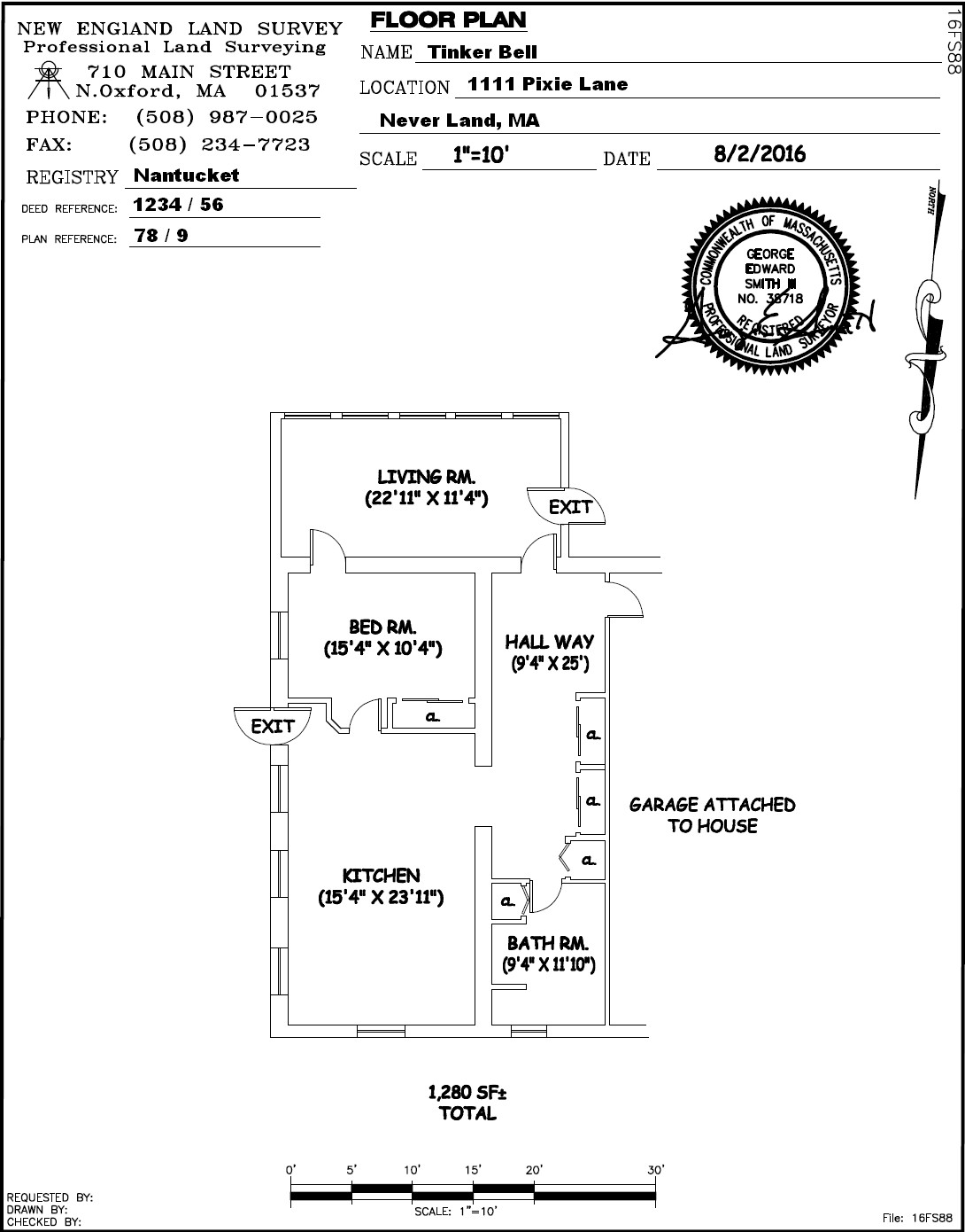
Sample Floor Plan
A floor plan is a scale diagram of a room or suite of rooms viewed from above. Often, it is used for planning effective use and arrangement of furnishings. A floor plan is included in a full boundary survey. A full boundary survey determines property lines and defines true property corners of a parcel of land described in a deed.
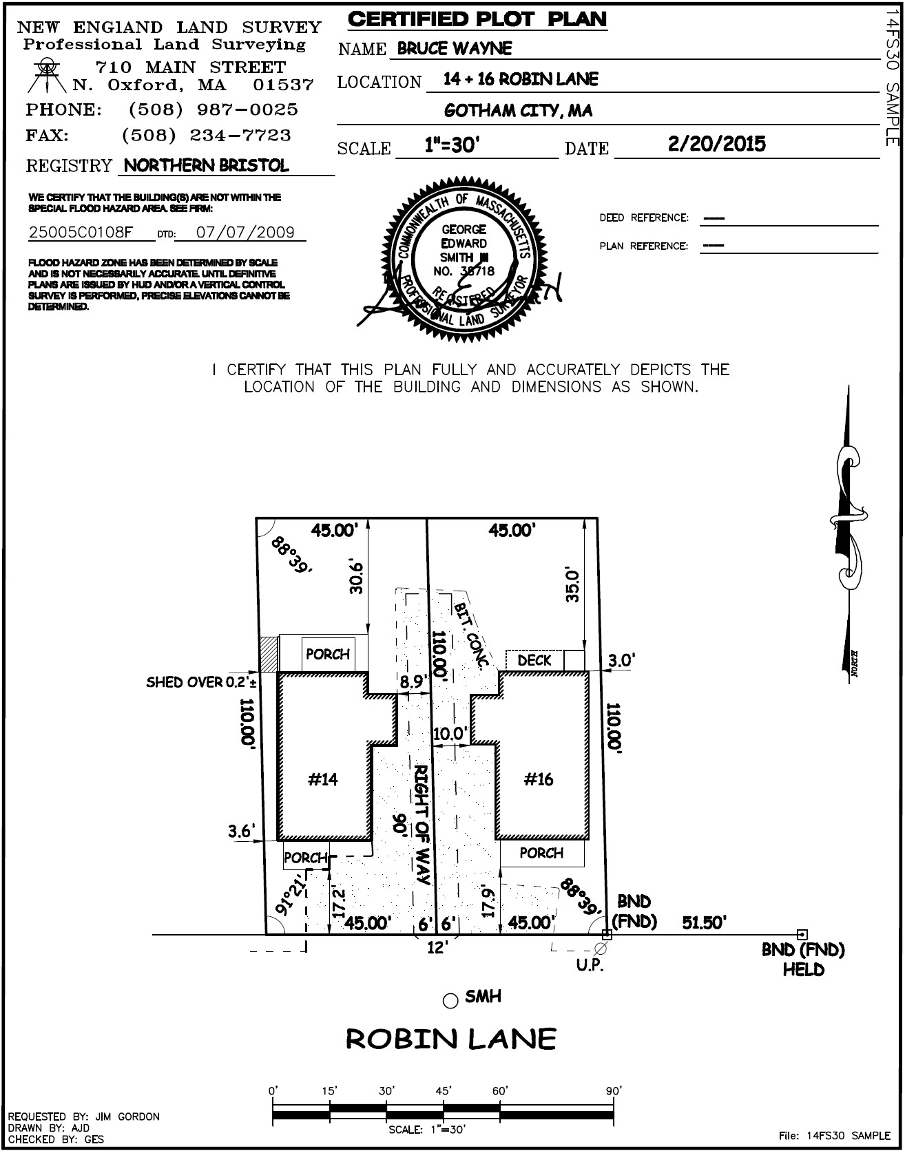
Sample Plot Plan
A full boundary survey includes a plot plan. This process carried out to determine property lines and define true property corners of a parcel of land described in a deed. Also, this indicates the extent of any easements or encroachments. As a result, you can see any limitations by state or local regulations that are imposed on your property.
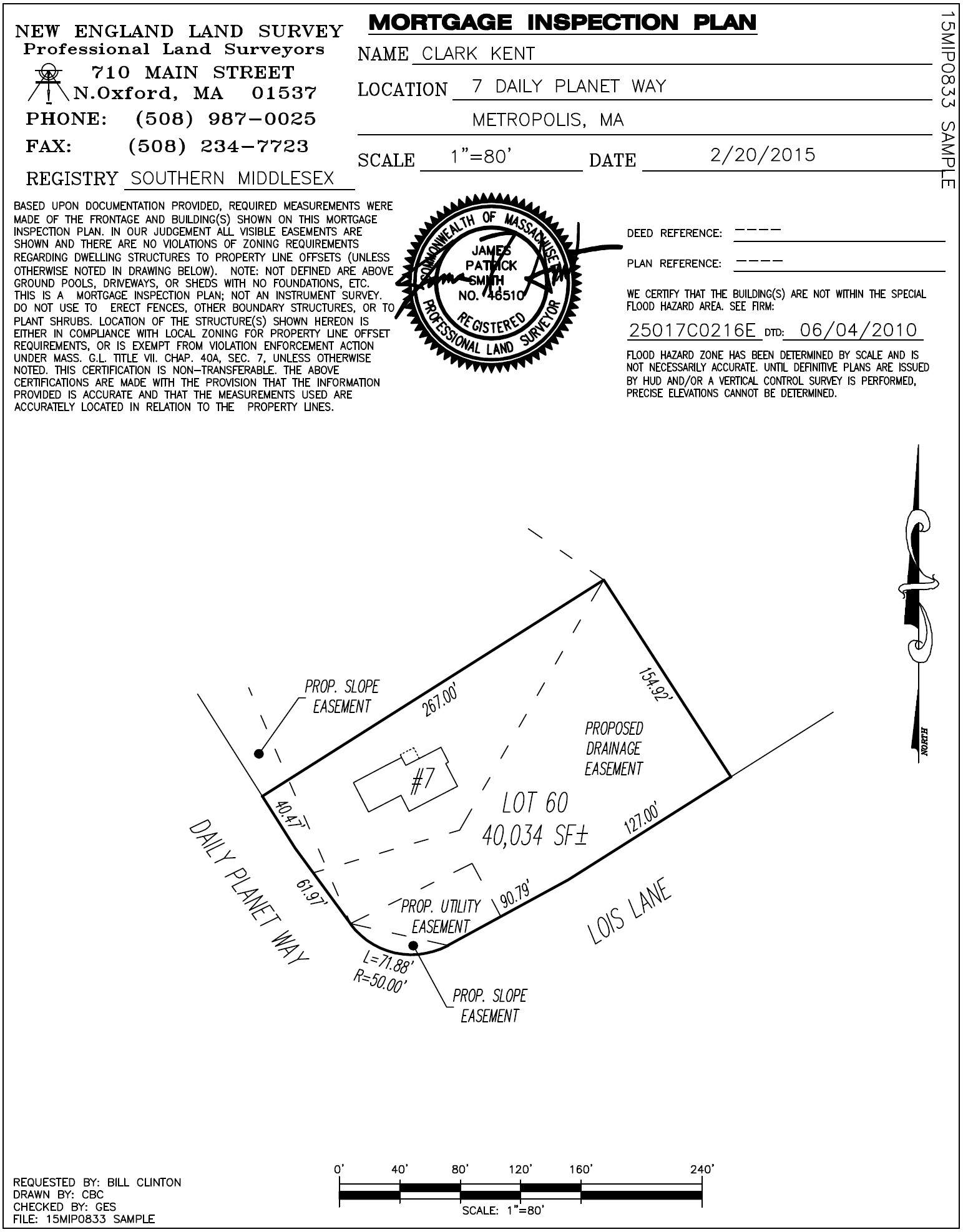
Sample Mortgage Inspection
A Mortgage Inspection Plan shows the approximate the location of any existing structures on a property. In addition, it highlights any possible encroachments on the property. The purpose of the plan is not to use extreme accuracy in measurements.